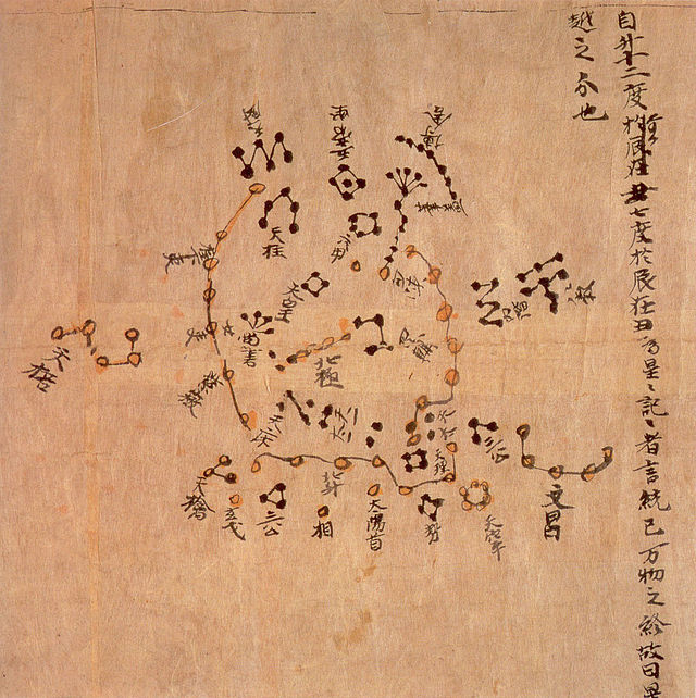
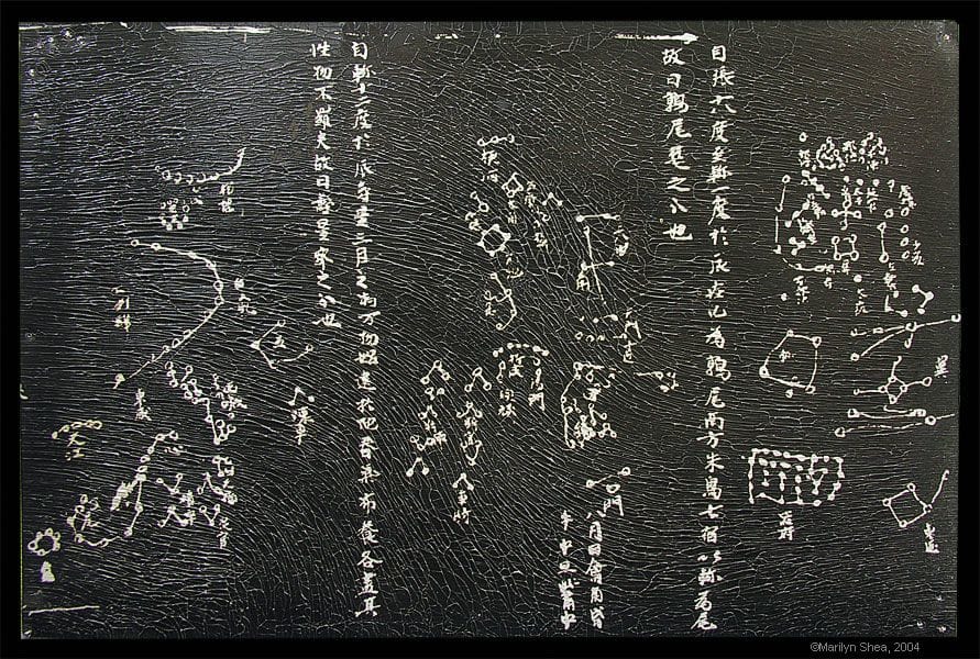
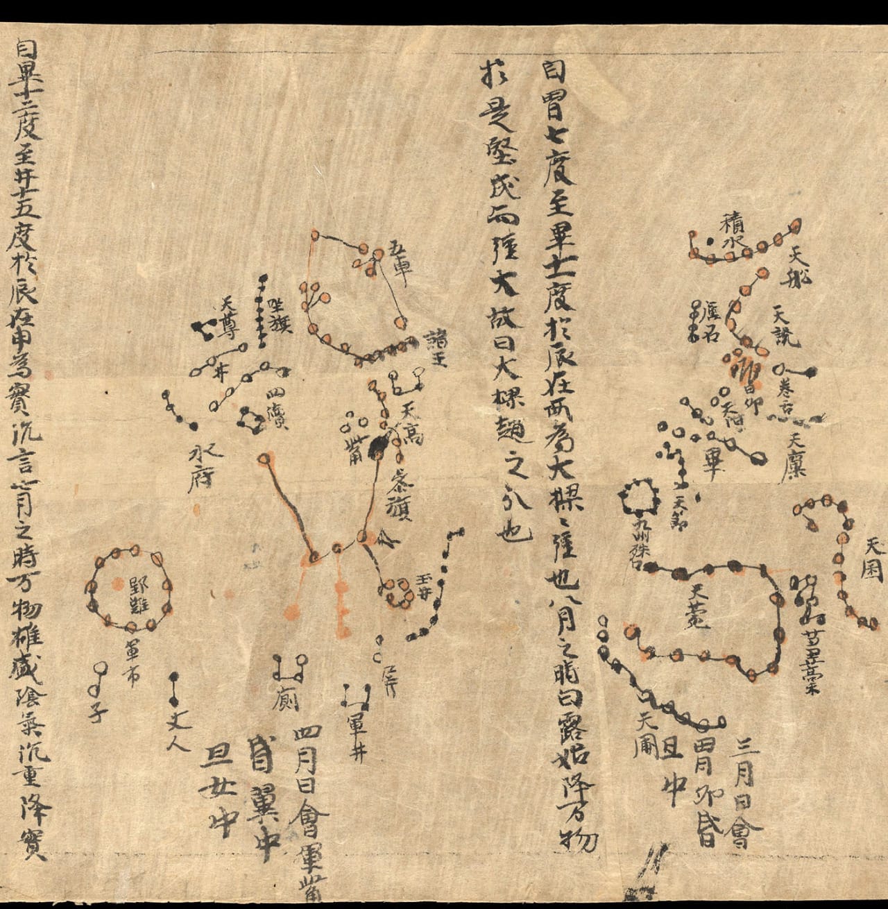
The Dunhuang Star Chart is one of the first known graphical representations of stars from ancient Chinese astronomy, dated to the Tang Dynasty (618–907). A recent analysis notes the atlas marks positions of over 1,300 stars and outlines 257 Chinese star groups. The star positions in the hand drawn atlas were found to be accurate to within a few degrees.
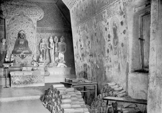
The Dunhuang Star Map was found in the Dunhuang Mogao Grotto(敦煌莫高窟) in a cache of manuscripts in a covered alcove. At that time, the Grottos were all but abandoned and the monk who found them was selling manuscripts piece by piece to support himself and what was left of the monastary. In 1907, Aurel Stein and Paul Pelliot bought over 9000 objects and manuscripts from him. They sent trunks of items to Beijing to try to alert the government to the importance of the find, but most of the items disappeared into private collections. The rest were sent to Europe. The Dunhuang Star Map is now housed in the International Dunhuang Project at the British Library in London, United Kingdom.
The star map has recently been dated back to the 700s. Earlier it was thought to date to the 900s. The map contains 1,350 stars in thirteen sections. One of the most interesting features of the charts is that they used two different methods to display the stars. One was a cylindrical projection for the stars around the horizon. When you flatten a curved object it changes the relationship among the objects on the surface. It is like a Mercator projection first seen in Europe in 1568.
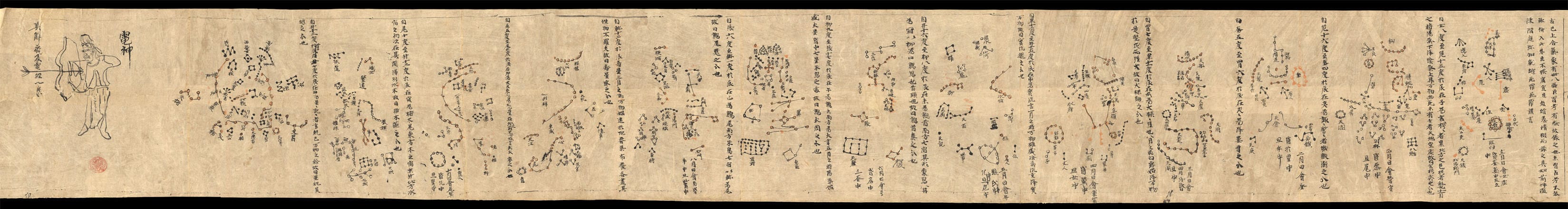
Imagine cutting a ball to try to flatten it. You would have large segments of empty space between the slices of ball. On a cylindrical map, the lines of the ball are straightened artificially to maintain some relationship between the objects on the ball. This works fairly well on the equator or in the case of the sky, the horizon. When you get to the poles, the distances of the flattened slices are extremely distorted. To solve the problem, on the Dunhuang Star Map they used a circular polar projection method to draw the region around Polaris. That method, if used alone, would have distorted the measurements at the horizon.
What was it doing in Dunhuang? Usually such materials would be found in imperial archives. It is speculation, but it could have been used to guide travelers along the Silk Road. Dunhuang was the last major resting place before starting on the journey on the north or south routes across the Taklamakan desert to the west. (text source)
Related from contemporary science: The oldest extant star chart