The Central European Net (CEN)
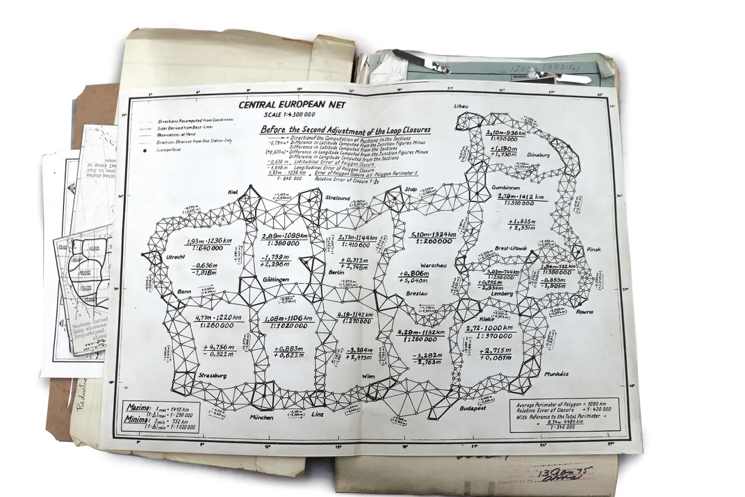
This image displays a historical geodetic map titled the "Central European Net," specifically illustrating the network Before the Second Adjustment of the Loop Closures. This map represents the framework for the first unified triangulation of the European continent, a project that laid the foundation for modern mapping in the region.
The Central European Net (CEN)
- Historical Context: The project originated in April 1945, after the U.S. Third Army captured the German Army's geodetic section and its extensive archives near the end of World War II.
- Purpose: The Allies, specifically the U.S. Army Mapping Service, realized the value of this data to create a single, unified geodetic reference system for Europe. Previously, the continent was fragmented into numerous independent national datums, which caused significant mapping errors, particularly for artillery targeting during the war.
- Methodology: The captured German scientists, led by Professor Erwin Gigas, were put to work under U.S. supervision in Bamberg to perform a least-squares adjustment of the triangulation data using methods like the Bowie Junction method.
- Outcome: The completed Central European First-Order Triangulation Adjustment (CEN) was finished in June 1947 and served as the anchor for expanding the network across all of Europe, eventually leading to the creation of the European Datum 1950 (ED50).
More on similar historical geodetic maps and related historical accounts of the "HOUGHTEAM" mission to capture this critical German data here: The Untold Story of the Secret Mission to Seize Nazi Map Data